Get closer with 100-meter Natural Earth
I created this larger-scale version of Natural Earth in 2013 for the US National Atlas administered by the US Geological Survey. The 100-meter data has since become difficult to find because of the discontinuation of the US National Atlas program. So, I have re-released it here.
The georeferenced images offered below precisely match US National Atlas 1:1 million vector data. Their intended use is general purpose mapmaking. As with other versions of Natural Earth, the colors and textures are relatively light to minimize conflicts with lines, symbols, type, and other overprinting map elements. Regrettably, the dataset does not include adjacent lands in Canada and Mexico.
Some of the 100-meter Natural Earth images are very large. For example, the contiguous US is nearly 50,000 pixels wide and requires 16 feet of paper to print at 254 DPI. I split the contiguous US and Alaska images into east and west halves (with a bit of overlap) to keep them below the 2 GB GeoTIF file size limit.
Tom Patterson
April 5, 2020
Download 100-meter Natural Earth
100-meter Natural Earth Map Data
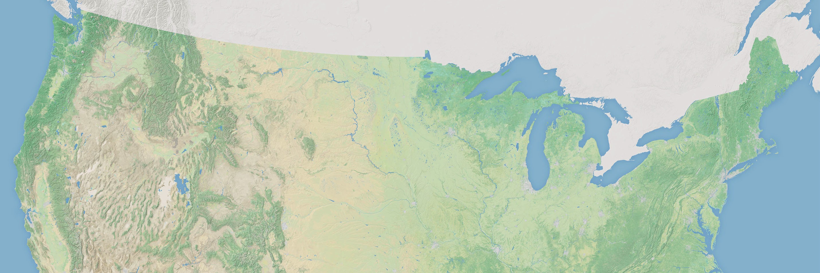
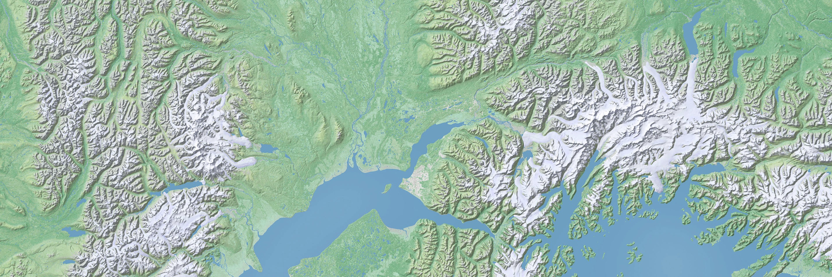
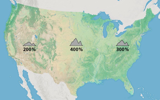
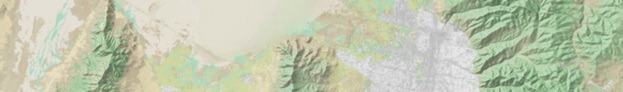
Shaded relief is a major component on 100-meter Natural Earth. It combines lightly with the land cover colors by eliminating gray tones from the flat areas so that only the relief highlights and shadows remain. This action resulted in land cover colors in flat areas that were less muddy. Because topography of the contiguous United States varies greatly between regions, I used different amounts of vertical exaggeration for rendering the shaded relief. For example, the rugged Rocky Mountains received half as much vertical exaggeration compared to the gentler Great Plains and southeastern coast. Had I applied a uniform amount of vertical exaggeration everywhere, only one of these regions would have benefitted at the expense of the others. For example, with 400 percent vertical exaggeration, the relief for the Rocky Mountains would be too bold. And 200 percent vertical exaggeration in the Great Plains would barely be visible.
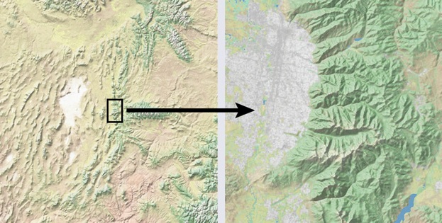
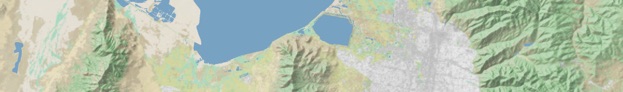
(left) Natural Earth 1 at 1.85-kilometer resolution centered on Salt Lake City, Utah. (right) Natural Earth created for the US National Atlas at 100-meter resolution.
Alaska - GeoTIF, 38,900 × 20,920, 442.5 MB
Contiguous US - GeoTIF, 49,810 × 31,390, 1.66 GB
Hawaii - GeoTIF, 7,060 × 4,420, 4.5 MB
Puerto Rico & US Virgin Islands - GeoTIF, 4,820 × 2,080, 2.2 MB
Alaska - GeoTIF, 38,900 x 20,920, 282.5 MB
Contiguous US - GeoTIF, 49,810 × 31,390, 1.21 GB
Hawaii - GeoTIF, 7,060 × 4,420, 4.0 MB
Puerto Rico & US Virgin Islands - GeoTIF, 4,820 × 2,080, 1.6 MB
Alaska - GeoTIF, 38,900 × 20,920, 444.7 MB
Contiguous US - GeoTIF, 49,810 × 31,390, 1.67 GB
Hawaii - GeoTIF, 7,060 × 4,420, 4.5 MB
Puerto Rico & US Virgin Islands - GeoTIF, 4,820 × 2,080, 2.2 MB
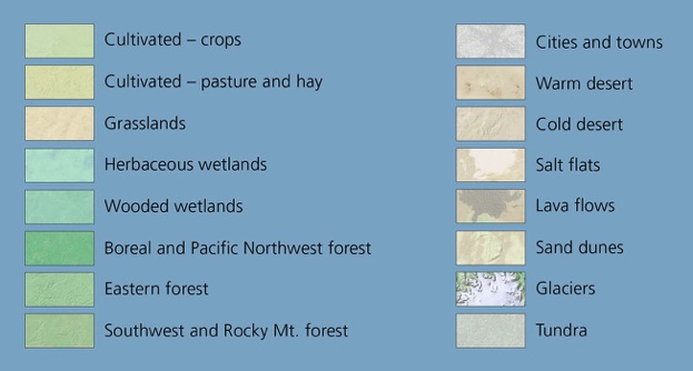
Land Cover
Land Cover + Shaded Relief
Land Cover + Shaded Relief + Water Bodies
About the data
Terms of use
The 100m Natural Earth data on this website are in the public domain. You are welcome to use it anyway you want. Citing the data is not required.
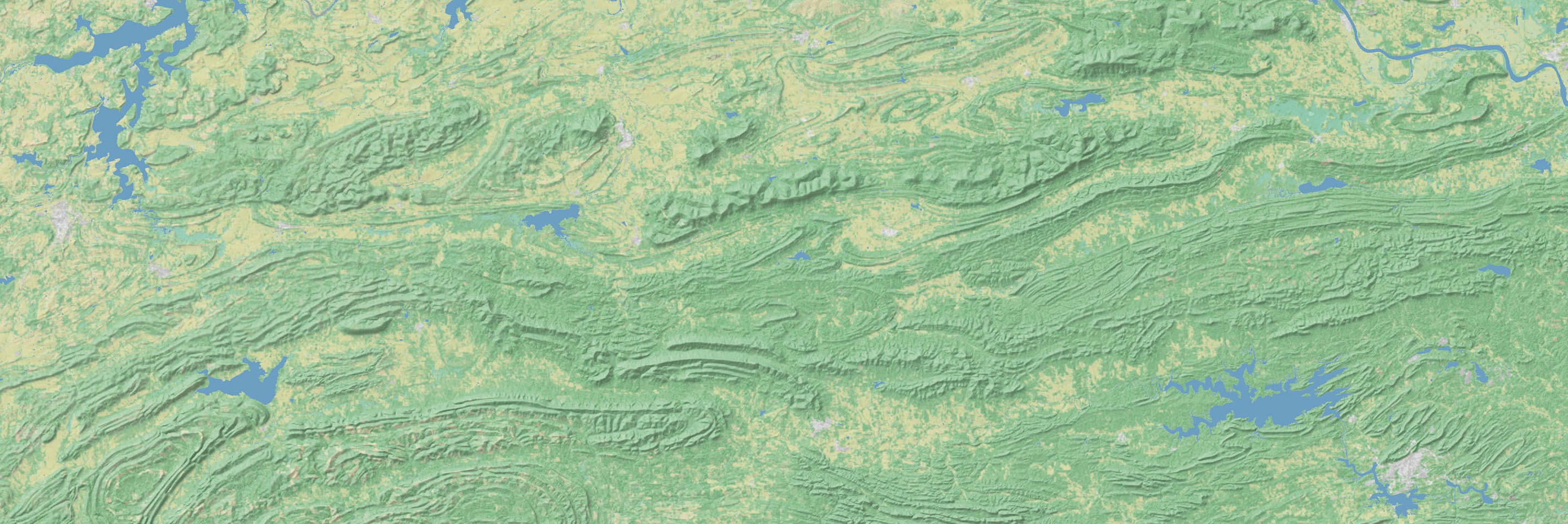
I constructed 100-meter Natural Earth from different source data compared to the previous versions. Instead of MODIS Vegetation Continuous Fields, the 100m version was based on National Land Cover Dataset (NLCD), a US Geological Survey product derived from Landsat imagery. The pixels in NLCD represent discrete classes of land cover, to which I assigned a new palette resembling the colors found in previous versions of Natural Earth. Applying a slight amount of Gaussian blur to the re-colorized NLCD softened the harsh pixel boundaries.
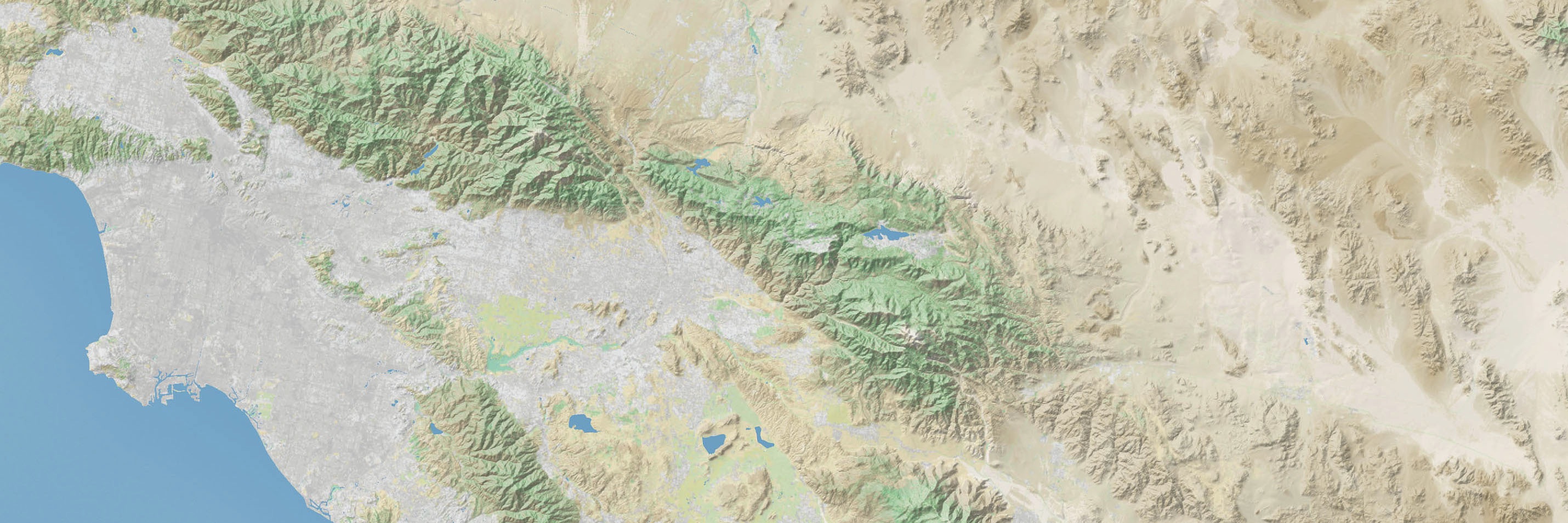
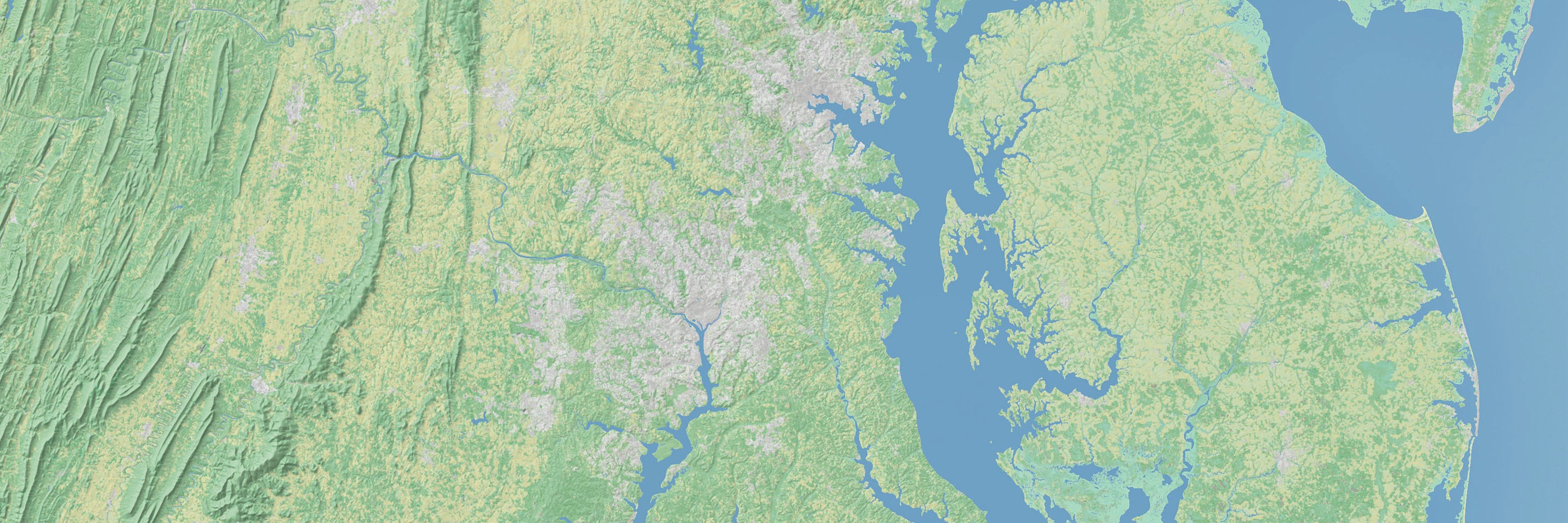
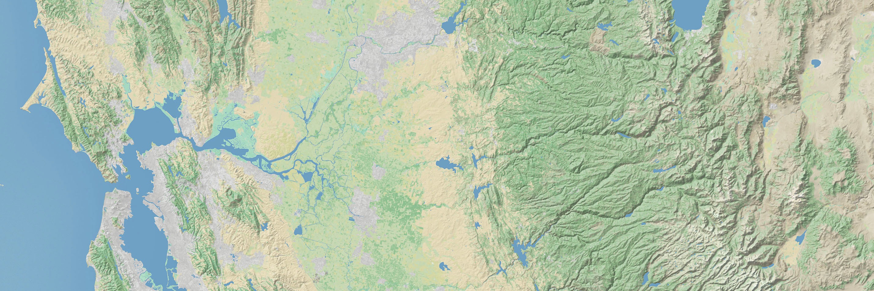
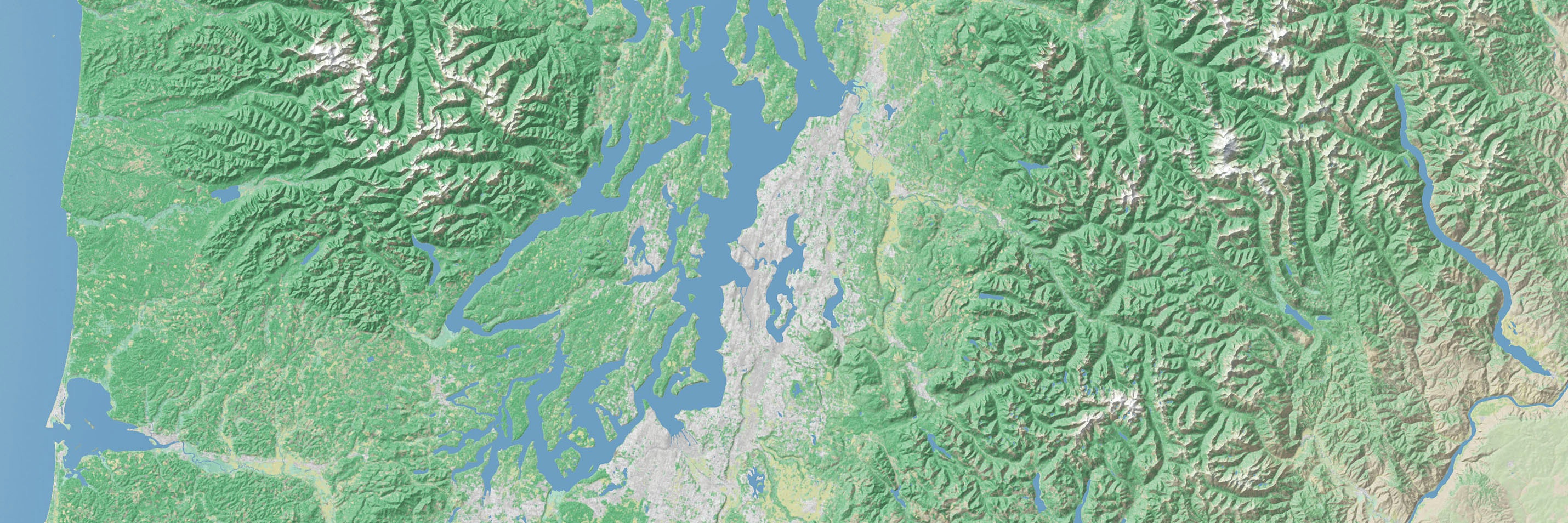
Urbanized areas depicted with shades of gray are a unique addition to the 100-meter version of Natural Earth. I filtered the urban NLCD data to remove the thin highway corridors between towns and cities. I also enhanced flat, uninteresting swathes of NLCD data by adding textures from mosaicked Landsat satellite images. Glaciers, wetlands, lava flows, salt flats, and the shrub lands covering large areas of the arid west all received Landsat textures.
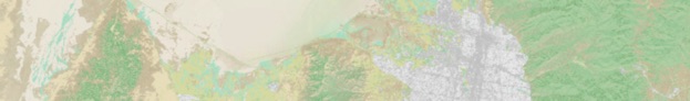
(left) Salt flats and shrub lands near Las Vegas, Nevada, without Landsat textures. (right) The same area with Landsat textures.
Land cover classification for 100-meter Natural Earth
Shaded relief rendered with varying amounts of vertical exaggeration depending on the ruggedness of US regions.
Projection information
All 100-meter Natural Earth images are in the Albers Equal-Area projection, NAD83 datum. They use the projection parameters recommended by the US Geological Survey for each respective region:
Alaska
Central meridian: 154W
Latitude of origin: 50N
First standard parallel: 55N
Second standard parallel: 65.5N
Contiguous US
Central meridian: 96W
Latitude of origin: 23N
First standard parallel: 29.5N
Second standard parallel: 45.5N
Hawaii
Central meridian: 157W
Latitude of origin: 3N
First standard parallel: 8N
Second standard parallel: 18N
Puerto Rico and US Virgin Islands
Central meridian: 66.5W
Latitude of origin: 15N
First standard parallel: 8N
Second standard parallel: 18N
Getting 1:1 million vector data
Coastlines, rivers, lakes, political boundaries, etc. from the discontinued US National Atlas are available on EarthExplorer. But you will have to jump through a few hoops. Click the "Data Sets" tab then select Digital Maps/National Atlas. Then click the "Additional Criteria" tab and specify Collection/1:1,000,000-scale before clicking the "Results" button in the lower right.
For smaller-scale Natural Earth data, visit: NaturalEarthData.com
Available for the United States, Puerto Rico, and US Virgin Islands