|
|
|
Mountain Cartography Workshop Maps
|
|
|
|
|
|
Tom Patterson
|
|
|
|
|
|
At the ICA Mountain Cartography Workshop held in Banff, Alberta, I introduced two prototype maps made in part with Terrain Texture Shader software. Both maps feature textures rendered from digital elevation models that resemble the hand-drawn rock hachures found on topographic maps of the Alps. The new rock texturing technique works best on cliffy landscapes with horizontal strata.
The downloadable maps below are in the public domain and you may use them however you wish, including commercially. The article below discusses how I made these maps.
Enhancing Shaded Relief with Terrain Texture Shader
|
|
|
|
|
|
 |
|
|
|
|
|
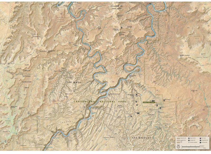
The Heart of Canyonlands National Park, Utah
|
|
|
|
|
|
Brad Washburn's 1978 The Heart of the Grand Canyon, co-produced with National Geographic and with contributions from SwissTopo, inspired the making of this map. The arid-land textures derive from shaded relief, texture shading, and NAIP aerial photos blended together. The river rapids are the only manual element, which I painted in Adobe Photoshop using NAIP as a guide.
|
|
|
|
|
|
 |
|
|
|
|
DOWNLOAD
Screen-viewable map (13.3 MB) – 6,480 x 4,736 pixels
High-resolution wall map (41.8MB) – 12,960 x 9,472 pixels (36 x 26.3 inches at 360 DPI)
|
|
|
|
|
|
|
|
|
|
|
|
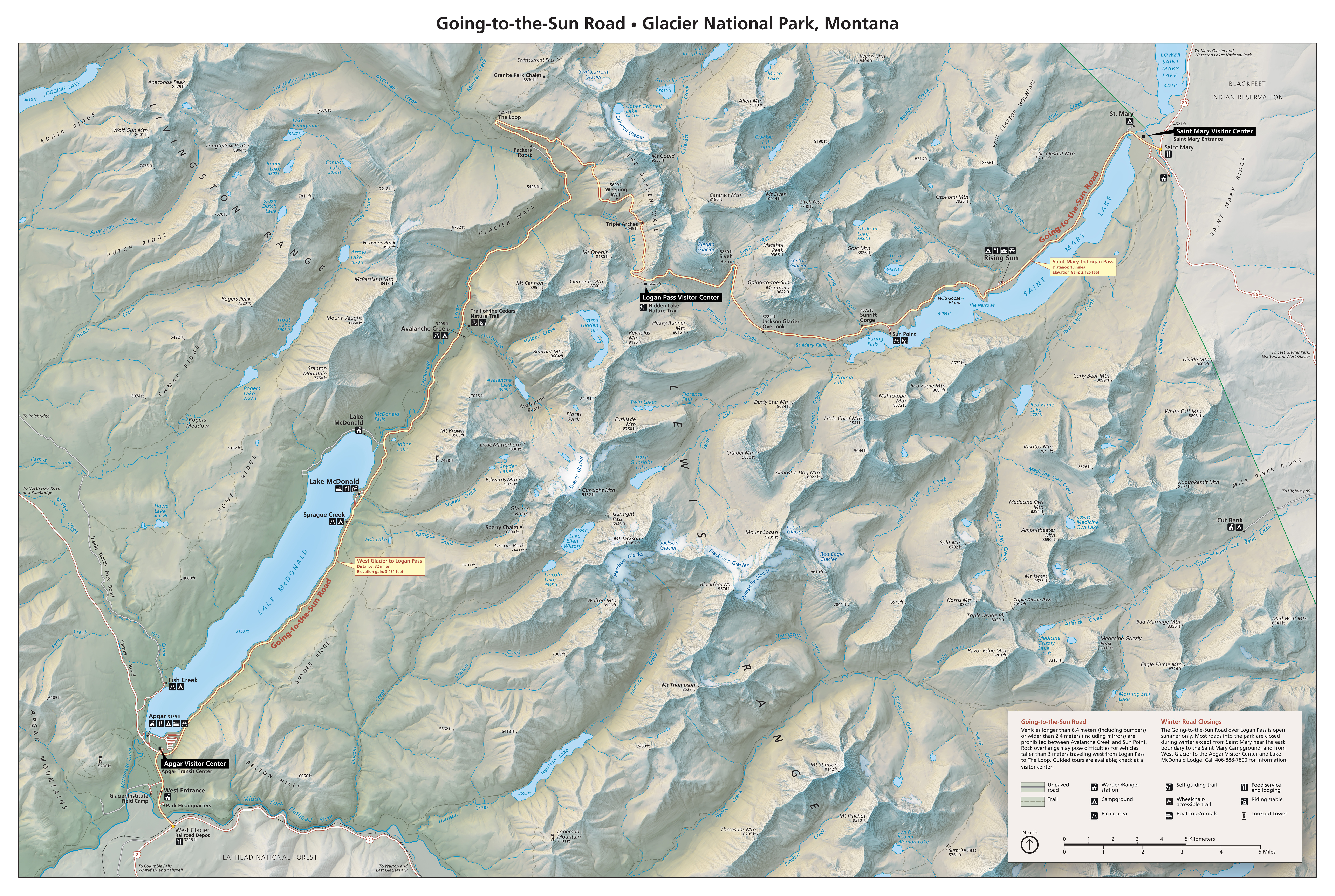
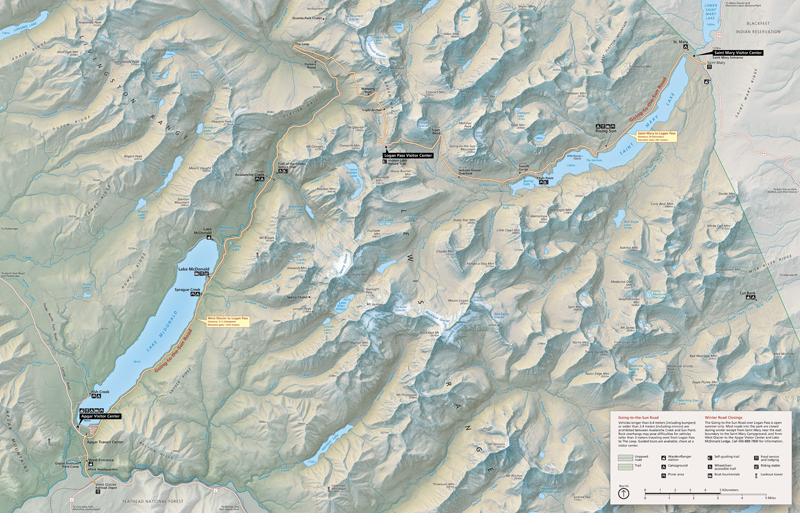
Going-to-the-Sun Road, Glacier National Park, Montana
|
|
|
|
|
|
In designing this map I drew inspiration from Swiss topographic maps characterized by mid-elevation slopes illuminated in warm yellow transitioning to white at the summits, and shadowed slopes depicted in cold gray-blue. The map highlights the 50-mile (81-kilometer) Going-to-the-Sun Road crossing the spine of the Rockies.
|
|
|
|
|
|
 |
|
|
|
|
DOWNLOAD
Screen-viewable map (7.6 MB) – 6,480 x 4,350 pixels
High-resolution wall map (22 MB) – 12,960 x 8,700 pixels (36 x 24.2 inches at 360 DPI)
|
|
|
|
|
|
Return to ShadedRelief.com
|
|
|
 |
|
|
|
|
|