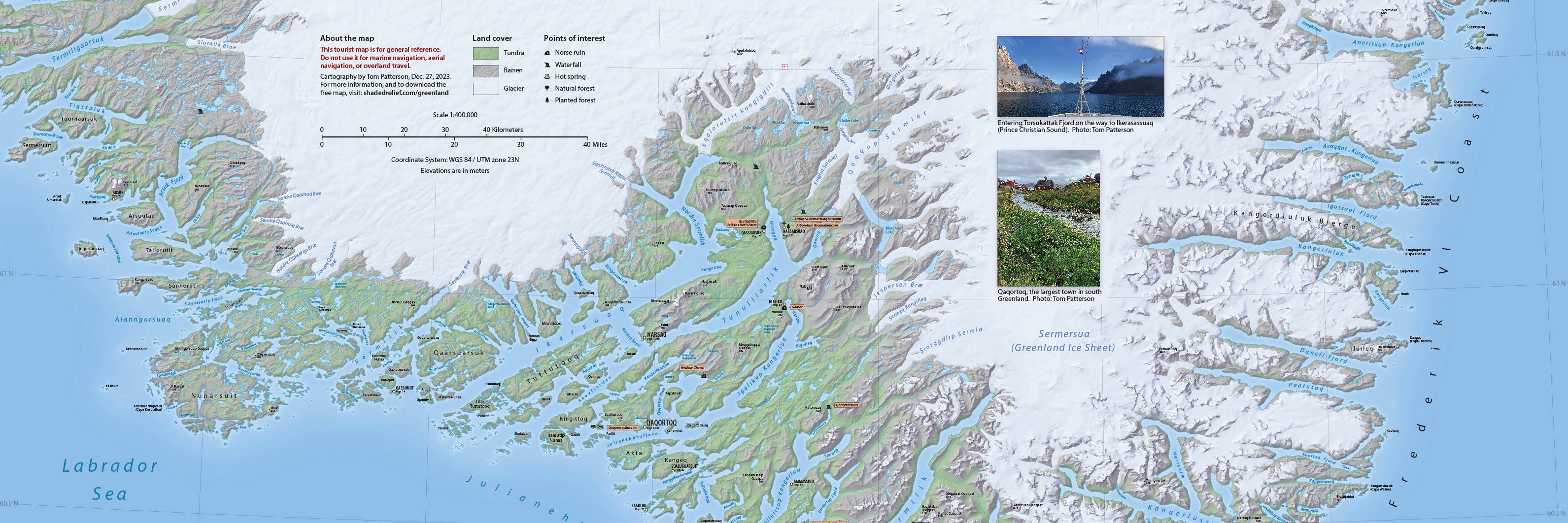
About the map
As a retired US National Park Service cartographer and admirer of dramatic landscapes, I am always on the lookout for new places to map. The islands, fjords, and glaciers of southern Greenland captivated me during a brief visit there in 2022. I was also seeking a test project on which to use ArcticDEM elevation data rendered with Eduard relief shading software.
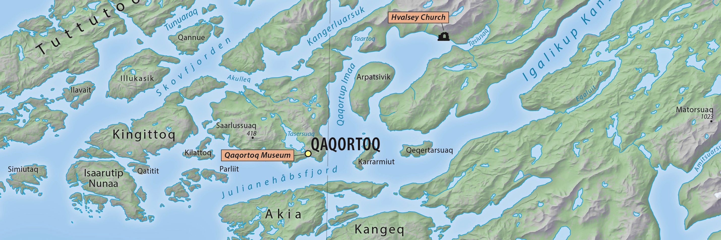
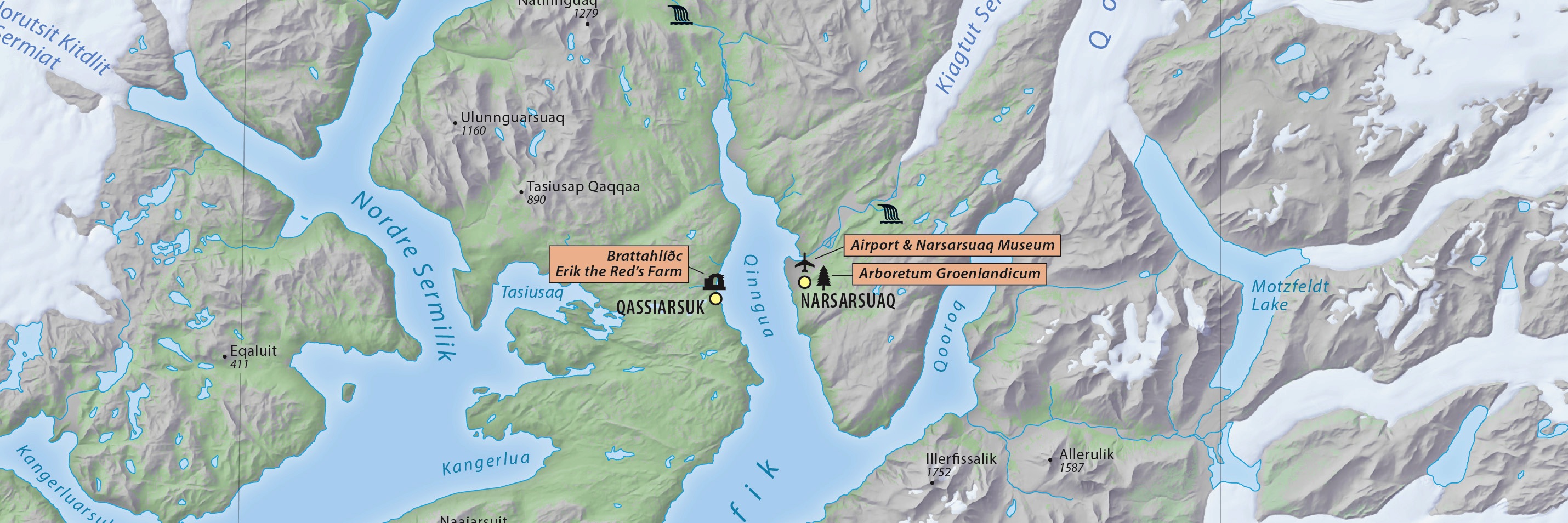
Another incentive was the varied land cover that allowed me to add a splash of green to the map. The climate of the interior fjords of southwestern Greenland is just warm enough to support small farms and a few pockets of low forest. The ruins of medieval Norse settlements dot the region.
I hope that you will find this map informative and useful.
January 2, 2024
Get the map: Pick the version best for you
Last update: Version 1.0, January 2, 2024 Change log
Screen viewing and high-quality printing:
RGB JPEG image, 38 x 25 inches, 350 DPI, 21 MB
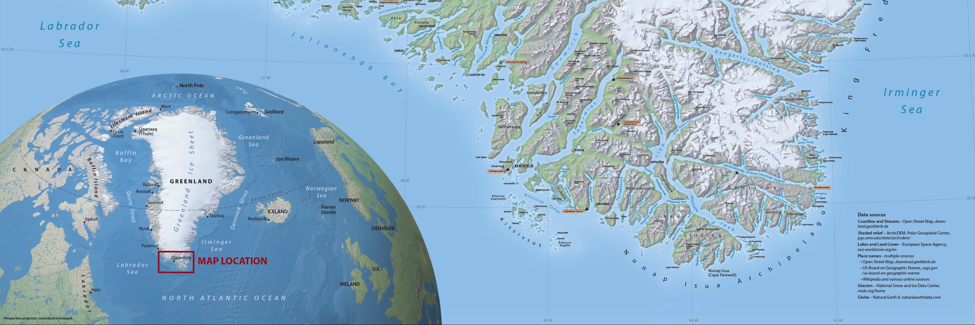
Exploring Greenland's Southern Tip
Visitor Map
Modifying the map:
Layered Adobe Illustrator CC file with MAPublisher georeferencing, includes terrain art, 254 MB
Additional files for GIS and mapmaking
Georeferenced raster map GeoTIF, 89 MB
Terrain art without type GeoTIF, 116 MB
Data sources
Coastline and Streams - Open Street Map. download.geofabrik.de
Shaded Relief - ArcticDEM, Polar Geospatial Center. pgc.umn.edu/data/arcticdem/
Lakes and Land Cover - European Space Agency. esa-worldcover.org/en
Place names - multiple sources
• US Board on Geographic Names. www.usgs.gov/us-board-on-geographic-names
• Open Street Map. download.geofabrik.de
• Wikipedia and various online sources
2021 Town Populations - Wikipedia
Glaciers - National Snow and Ice Data Center. nsidc.org/home
Globe - Natural Earth II. naturalearthdata.com
Terms of use
This map was made with geospatial data generously provided by others that require attribution. You are welcome to reproduce, distribute, or modify the map on condition that the sources are cited.
By downloading and using this map you agree that the map author (Tom Patterson) is not legally responsible for any errors that the map may contain. You are solely responsible for all problems that may arise from reuse of the map and distribution to third parties. Tom Patterson does not necessarily endorse the individuals or organizations that may use the map, nor does he endorse their positions on issues.
This tourist map is for general reference only. Do not use it for marine navigation, aerial navigation, or overland travel.
The map measures 96 x 64 centimeters (38 x 25 inches) at 1:400,000-scale.
Going mobile
Point your phone's camera here to get the map.
Locate yourself while travelling with the free Avenza Maps app for iOS and Android. It works when you are off the grid using the built-in GPS 0n your phone or tablet.