


Draft vector data now available
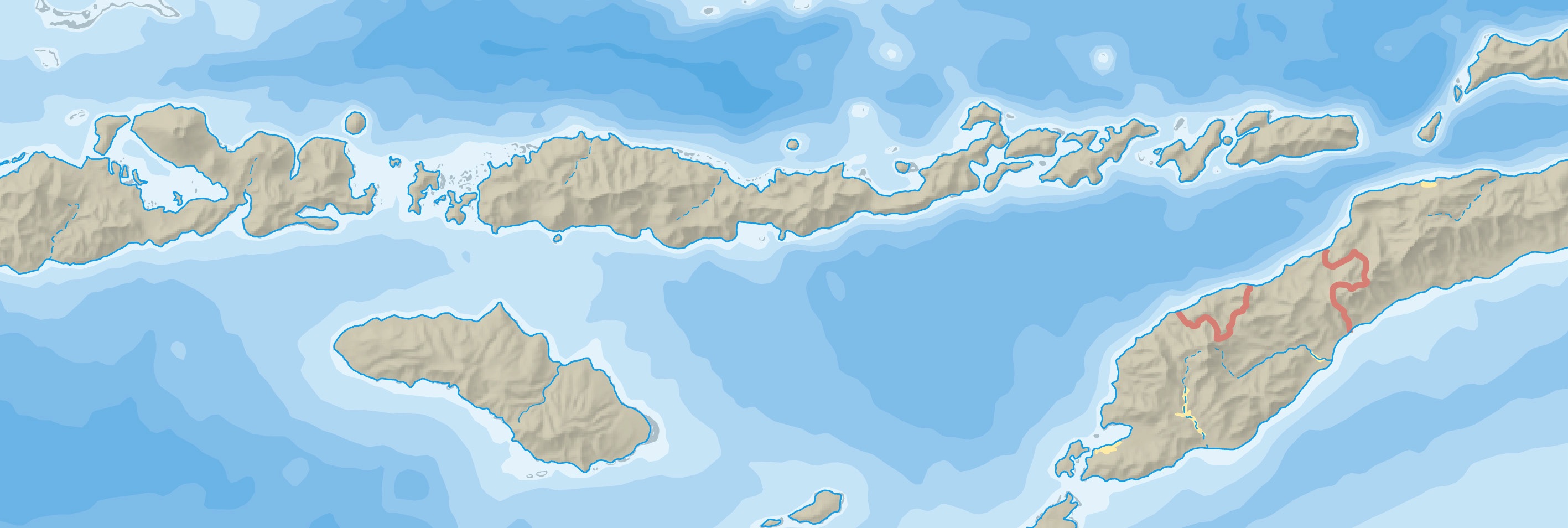
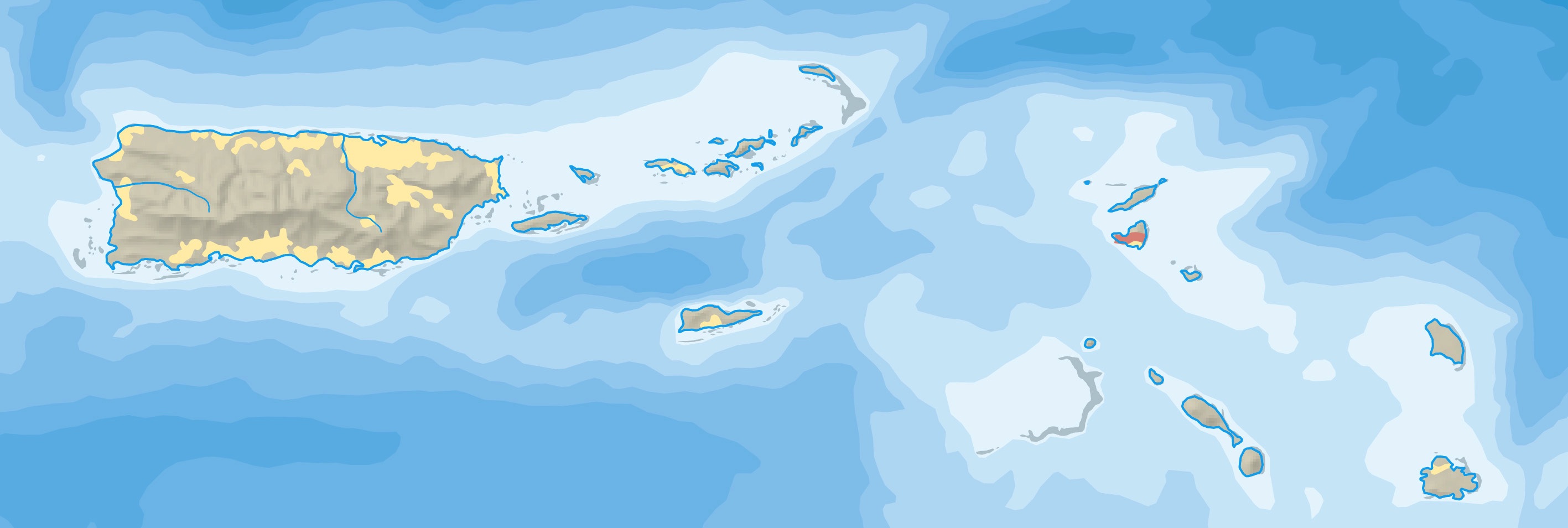
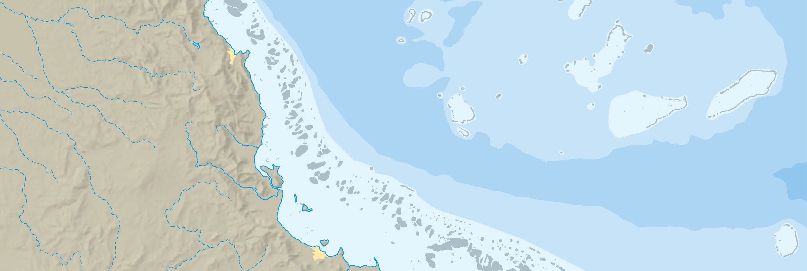
We announced plans at the 2021 NACIS conference to build a more accurate and slightly more detailed new version of Natural Earth. Hydrography—coasts, rivers, lakes, glaciers, and ice shelves— would serve as a foundation for the rebuilt dataset. Eighteen months and countless hours later, we are pleased to show you what we created.
Below you will find links to the draft data, which now covers the entire world. There's a lot of stuff, including 14,575 rivers, 7,623, lakes, 4,211 glaciers, 14,748 islands, and 376 Antarctic ice shelves.
The latest version (July 23, 2024) includes coral reefs.
Your feedback is essential for improving the dataset. Please report any problems that you spot, such as positioning errors, unconnected lines, wrong names, and features to be added or deleted. Thanks!
Natural Earth Volunteers
Rivers and lakes team: Corwan Groux, Mary Edin, Alex Fries, and Heather Smith
Populated places team: Leo Dillon, Kate Leroux, Brandon Plewe, and Zhaoxu Sui
A huge thanks to all the volunteers working to rebuild a better Natural Earth! If you enjoy geographic research and working with geodata, you are welcome to join us.
Tom Patterson and Nathaniel Vaughn Kelso
Learn More
WORLD Updated: July 23, 2024
Natural Earth 6.0
Preliminary Map Data at 1:7,500,000
Contact us
Have you spotted a problem? Or do you want to become a Natural Earth volunteer? We would like to hear from you.
Tom and Nathaniel
Draft Data
Video: 2021 NACIS conference presentation. 25:42
Video: 2022 NACIS conference presentation. 13:53
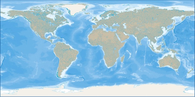
These preliminary data are a work in progress. Use with appropriate caution.
Besides physical features, the world base map also includes draft country borders (Admin0) and province or state borders (Admin1).
We will release country and admin1 polygon data after the admin0 borders are finalized.