Jewel of the Wasatch
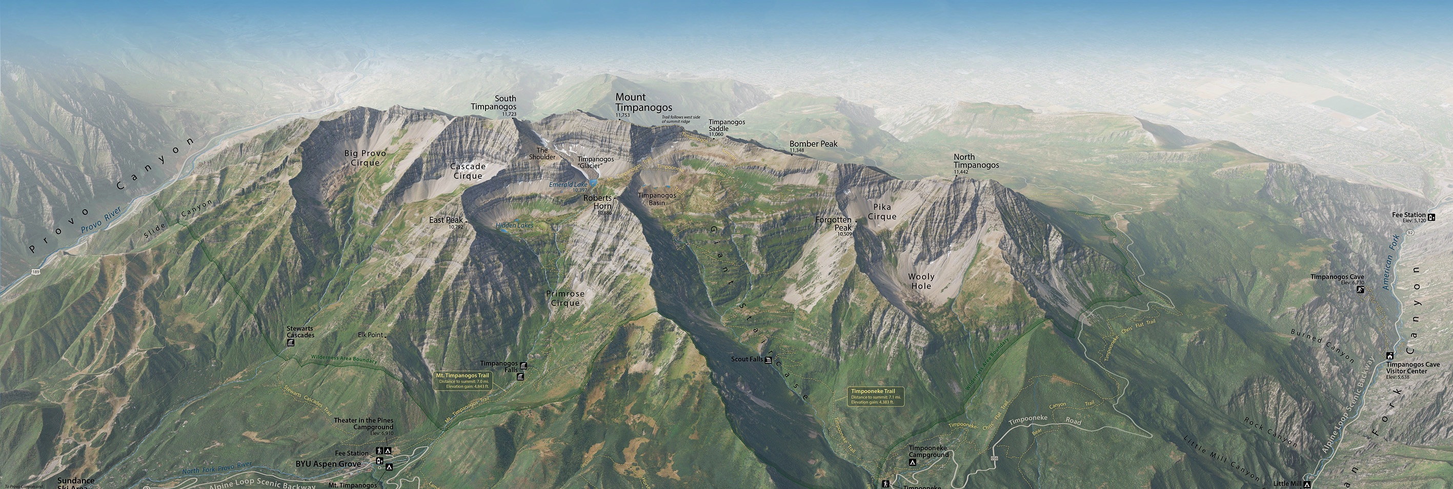
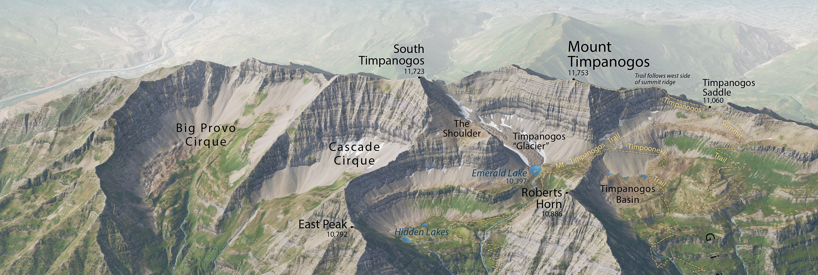
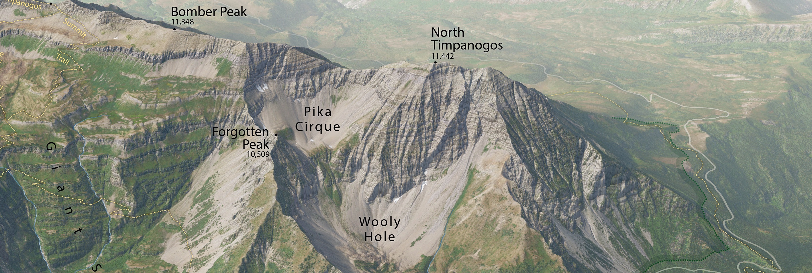
Mount Timpanogos is significant by any measure. It has a 4.5-mile long summit ridge rising 7,000 feet above Utah Valley to the west. The east side is a study in glacial geomorphology featuring arêtes, cirques, and horns. Another reminder of the last ice-age is a rock glacier clinging to existence just below the summit. Timpanogos is also an exceptionally beautiful mountain.
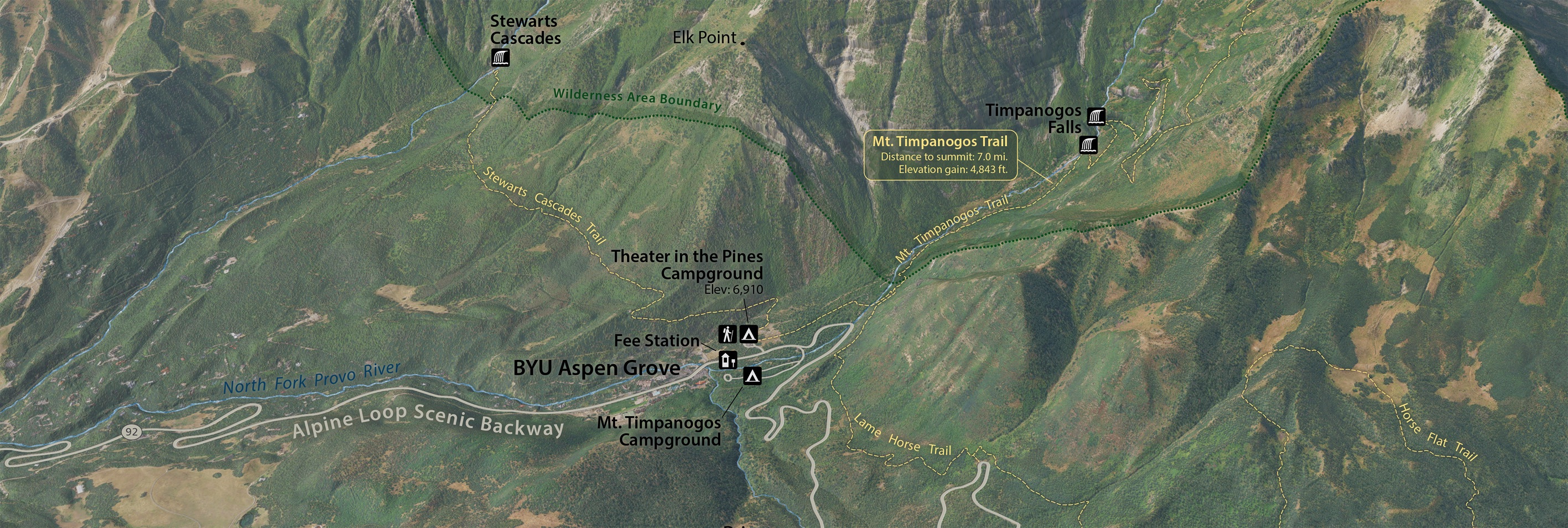
As the crow flies, "Timp" is only 29 miles from downtown Salt Lake City and 11 miles from Provo. The Alpine Loop Scenic Backway provides car access to Sundance Ski Resort and Timpanogos Cave National Monument, plus miles of trails that lead into the wilderness area that surrounds the mountain.
Although this 3D map may look photorealistic, it is a digitally-rendered image comprised of geospatial data. I hope that it inspires you to visit.
Tom Patterson
April 24, 2024
Download the panorama
Terms of use
The Mount Timpanogos Panorama is in the public domain. You may use it any way that you want. You are not required to cite the map.
Contact me
I will periodically update the map. Please let me know about major features to include or any problems that you find.
Thanks!
Tom Patterson Bio
Mount Timpanogos Panorama
Wasatch Range, Utah
Version 1.02, April 27, 2024 Change log
Prints 33" x 17.5" at 300 dpi