Making 3D Terrain Maps |
||||||||||
--Sky or no sky? |
||||||||||
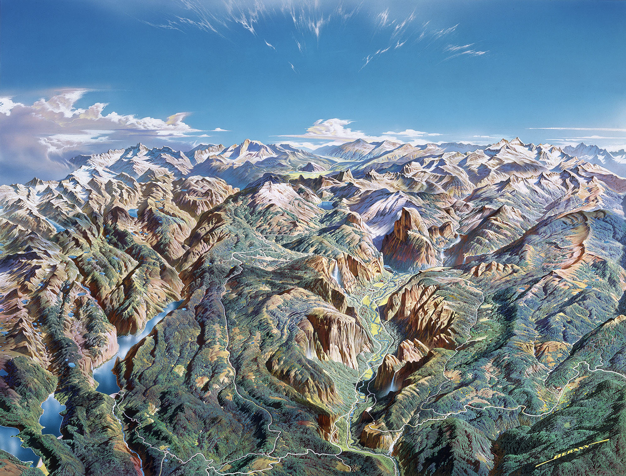
Whether to include a horizon and sky on a 3D terrain map is a fundamental decision for every project. Mapping history plays a role. Nearly every 3D terrain map made during the manual era included a sky, often adorned with beautiful clouds. Such skies were a hallmark of Austrian artist Heinrich Berann (1915-99), who painted over 500 maps and panoramas during his career (see Yosemite below). Berann's body of work has had an enormous influence on the field, for example, the typical ski area map with a cerulean sky. The tradition of showing horizons and skies on 3D terrain maps is still with us today. |
||||||||||
 |
||||||||||
Yosemite panorama painted by Heinrich Berann in 1989. (Click map to enlarge.) |
||||||||||
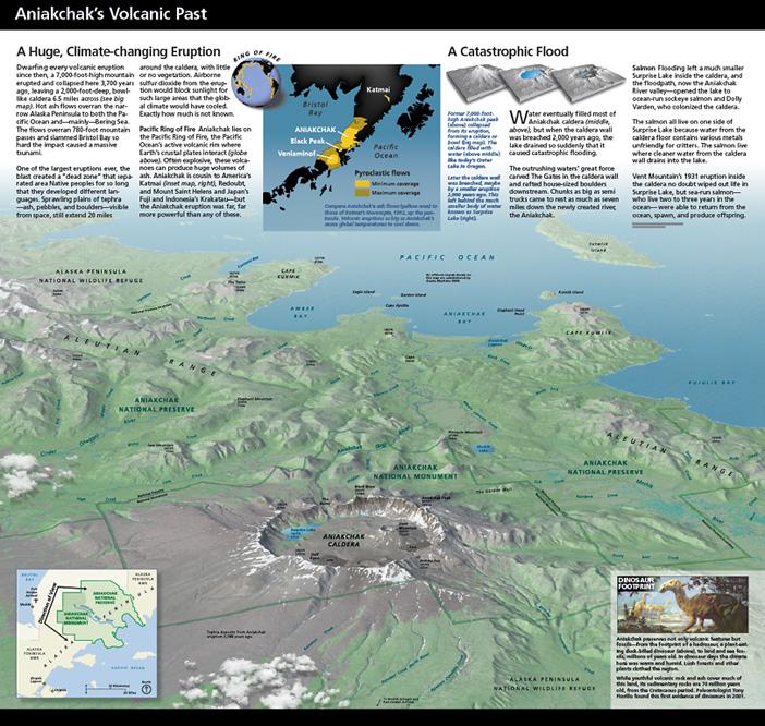
Including a horizon and sky on 3D terrain maps has advantages. For starters, they look really cool—can anyone not stare at a Berann panorama? By mimicking the view that we see from an airplane window, the horizon provides a familiar reference feature, visually anchoring the map. And the sky conveniently provides an excuse for putting blue on maps, a color most people find pleasing. There are also disadvantages to including a horizon and sky. They take up a lot of space. For example, on the Yosemite panorama above, the sky takes up roughly one third of the map. When you also consider the highly compressed terrain near the horizon, only about one half of the total map area is readable. On some maps, the sky is more interesting than the terrain below, distracting the reader with superfluous information. To include the sky in a scene, the view must be from a shallow angle, which increases the likelihood for occluded terrain. Last but not least, creating a sky adds considerable time to project development. Many of my 3D terrain maps do not have a horizon and sky because of limited space in graphical layouts. The map of Aniakchak below is fairly typical. Instead of abruptly truncating the map at the top, it fades to white providing a clean background for placed text and inset maps. By omitting the sky, the map focuses on the readable terrain in the foreground and middle ground. Compared to Berann's stand-alone Yosemite panorama with sky, Aniakchak without sky is a workman-like map that integrates with other graphical elements. It gets the job done. |
||||||||||
 |
||||||||||
Aniakchak National Monument, Alaska, brochure layout. |
||||||||||
 |
||||||||||
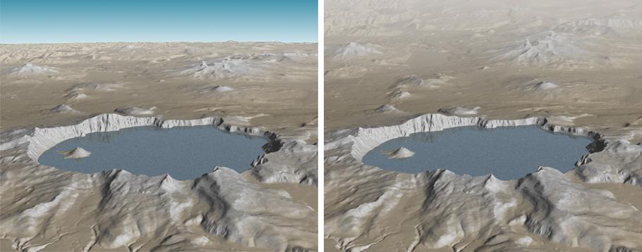
Crater Lake, Oregon, with a simple sky (left) and without a sky (right). Don't be seduced by skies. Making 3D terrain maps without skies is perfectly okay for most projects. |
||||||||||
 |
||||||||||