


In-depth—user tips and data
Part 1: User tips
Opening big files - At 32,400-pixels wide, Natural Earth at full resolution exceeds the 30,000-pixel size limit of older versions of Photoshop. Photoshop CS (8.0) or later can open files as large as 300,000-pixels wide, including Natural Earth at full resolution. If you have an older version of Photoshop and want to view Natural Earth in its entirety, open each hemisphere separately and downsample them to a width no greater than 15,000 pixels. Provided that you have enough RAM, you can then copy and paste the two hemispheres together as a single file.
Saving Natural Earth in Photoshop format (.psd) instead of TIF format significantly reduces the file size with no loss in image quality.
Byte order - Natural Earth TIF images use the Macintosh byte order, which is usually not an issue for PC users. If necessary, however, the byte order is easy to change in Photoshop. Open and resave Natural Earth as a TIF image, choosing the PC byte order option in the save dialog.
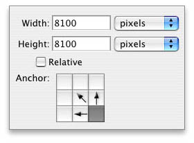
Cropping - Use the Canvas size dialog (Image/Canvas Size) in Photoshop to crop Natural Earth to precise latitude/longitude coordinates inward from the edges, which are fixed at 90N, 90S, 180W, and 180E. Because each degree of latitude and longitude on full-resolution Natural Earth contains 90 pixels respectively, calculating how much of the image to crop involves only simple arithmetic. To crop all four sides of Natural Earth you must use the Canvas size dialog at least two times in succession.
Selective color adjustments - Although Natural Earth is a single-layer image, adjusting colors selectively is still possible in Photoshop using the Selective Color dialog (Image/Adjustments/Selective Color). To lighten forests, select green from the color menu at the top of the dialog and move the black slider to the left. To tweak the color of herbaceous landcover, choose yellow in the pop-down menu; red adjusts desert colors. If the first application of Selective Color does not change a color enough, reapply Selective Color a second or even third time.
Shaded relief - Use special care when applying custom shaded relief to Natural Earth landcover. Eliminate the 10 or 15 percent gray normally found in flat areas on shaded relief to prevent the combined image from becoming dark and muddy. Using shaded relief illumination in addition to shadows creates topographic forms that appear more three-dimensional. Finally, for the sake of legibility, avoid using shaded relief derived from large-scale DEMs on small-scale maps.
Click here to download a layered Photoshop file (660k) with shaded relief applied to Natural Earth landcover.
Color printing - The NPS chose Natural Earth colors based partially on output from an HP Designjet 5000PS large-format printer. For similar results—bearing in mind that consistent color management is difficult to achieve—in the HP print dialog under advanced color options select AdobeRGB as the HP RGB emulation. If you have changed the color mode to CMYK, use SWOP as the HP CMYK emulation instead.
On a 1,200 DPI plotter you can print Natural Earth at resolutions as low as 125 DPI without seeing pixelization.
Part 2: Data sources
Landcover - Natural Earth landcover derives primarily from Moderate Resolution Imaging Spectroradiometer (MODIS) Vegetation Continuous Fields (VCF), a 500-meter resolution product of the University Maryland, Global Land Cover Facility. NASA's Terra satellite collects the raw data from which MODIS VCF derives.
MODIS VCF is comprised of three data channels, forest, herbaceous, and bare. Assigning flat colors (dark green for forest, light green for herbaceous, and gray for bare) to these channels, which blend into one another, creates an image of Earth that appears natural. To give the bare channel more visual interest (i.e. tonal modulation), a lightened and recolorized version of NASA's Blue Marble image substitutes for flat gray in desert and highland areas, which appear reddish-brown and gray-blue respectively.
For a full discussion of natural-color mapping techniques refer to this article.
Other data used in Natural Earth include:
Shaded relief - Downsampled SRTM30 with void-filling enhancements by Natural Graphics, except for Antarctica which derives from GTOPO30.
Bathymetry - ETOPO2 obtained from NOAA's National Geophysical Data Center website. Note: only the downsampled (10,800 x 5,400) version of Natural Earth uses bathymetry.
Glaciers and Antarctic ice shelves - Digital Chart of the World (DCW) 1:1,000,000-scale vector data originally developed by the US National Geospatial Agency (formerly DMA and, more recently, NIMA). Antarctic ice tones derive from Blue Marble. Greenland ice tones are blue-tinted shaded relief.
Arctic pack ice - Digitized from the CIA's Polar Regions Atlas, 1978, page 12. The stylized ice boundary depicts estimated absolute minimum sea ice extent, a theoretical concept rather than an observable geographic location. Use the pack ice overlay only for small-scale and generalized map presentations.
Seas, lakes, and rivers - Extracted from MODIS VCF. The eastern one-third of Iceland, arctic areas north of 80 degrees, all of Antarctica, and many mid-ocean islands are not included in the dataset. The water boundary accompanying GTOPO30 elevation data substitutes in the areas not covered by MODIS VCF.
International boundaries - ESRI Shapefile provided by the Office of the Geographer, US Department of State. Boundary representation is not necessarily authoritative.
AVHRR urban - Extracted from 1-kilometer resolution Global Land Cover Characteristics Data Base Version 2.0 distributed by the USGS.
MODIS urban - Extracted from 1-kilometer resolution Binary MOD12Q1 data (a MODIS-based product) obtained from Boston University, Department of Geography.
Part 3: Data issues
Of the nearly 525 million pixels that comprise Natural Earth, not all are perfect. Although created from satellite data, Natural Earth is a derivative graphical product that includes manual touchups. Use it accordingly.
The following are potential areas of concern for users.
Incomplete MODIS VCF landcover coverage - The eastern one-third of Iceland, arctic areas north of 80 degrees, all of Antarctica, and numerous ocean islands including Hawaii, Vanua Levu (Fiji), and the Shetland and Faroe Islands are missing from the data set.
Filling the voids in MODIS VCF landcover involved several methods. Polar areas where little vegetation grows were the easiest to manage. Working backward from water and glacier coverages obtained from other sources, all unglaciated terrestrial areas received a bare classification and gray coloration. For eastern Iceland, where measurable vegetation exists, Binary MOD12Q1 landcover substituted for the missing MODIS VCF to show the herbaceous tundra as a pale green tint.
Coloring small oceanic islands (most are only a few pixels wide) involved cloning landcover colors from nearby land areas with similar climate and vegetation characteristics. Manual painting in Photoshop using printed vegetation maps as a guide further enhanced the larger Hawaiian Islands.
Discolored pixels - Pixels with unexpected colors (typically red-brown and gray) fringe some ocean shorelines and interior water bodies that fluctuate in size, a by-product of merging MODIS VCF and Blue Marble datasets. Filtering and manual cloning with the Clone Tool (rubber stamp) in Photoshop eliminated most of the discoloration.
Snow removal - Another unwanted by-product of merged MODIS VCF and Blue Marble data was the appearance of patchy snow in the southern Andes and adjacent Patagonia between 35 and 45 degrees south latitude. Natural Earth depicts glaciers but not temporary snow cover. Sampling landcover colors from adjacent areas free of snow and painting in Photoshop removed the snow. The dramatic shaded relief of the Andes largely obscures this fix.
Ghosted shaded relief - The Blue Marble image contains embedded shaded relief. In desert and highland areas on Natural Earth, a faint impression of the shaded relief is visible where recolorized and lightened Blue Marble contributes to the landcover.
Polar areas - Reflecting the accuracy of the global datasets from which it derives, the resolution and general quality of data in polar regions on Natural Earth is less than that of other areas of the world.
Water - Only the largest rivers appear on the water layer provided with Natural Earth, discontinuously. The Aral Sea, Lake Chad, and Great Salt Lake look too large.
Return to Shadedrelief.com