 |
 |
 |
 |
 |
 |
|||||||
|
Natural Earth III – Clouds
|
||||||||||||
|
|
||||||||||||
|
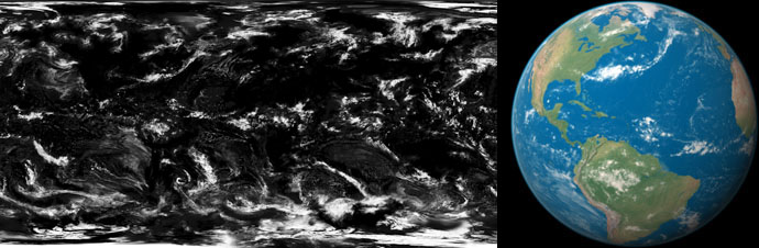
1. Fair weather – relatively few clouds over land thanks to Photoshop editing
|
||||||||||||
|
Cloud map |
Cloud map applied to globe |
|||||||||||
 |
||||||||||||
|
Download cloud map:...8,192 x 4,096 JPEG (7.3 MB) |
||||||||||||
|
|
||||||||||||
|
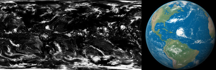
2. Storm warning – same as above, plus a cyclone, typhoon, and two hurricanes
|
||||||||||||
|
Cloud map |
Cloud map applied to globe |
|||||||||||
 |
||||||||||||
|
Download cloud map:...8,192 x 4,096 JPEG (7.4 MB) |
||||||||||||
|
|
||||||||||||
|
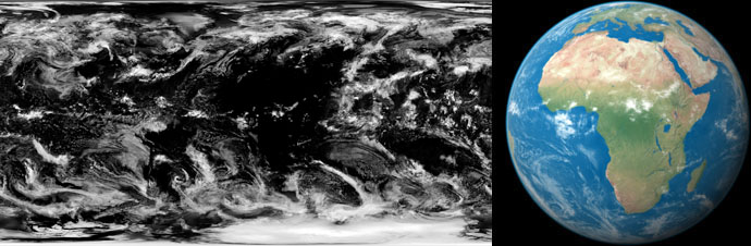
3. Africa – cloudy and hazy everywhere except Africa and Middle East
|
||||||||||||
|
Cloud map |
Cloud map applied to globe |
|||||||||||
 |
||||||||||||
|
Download cloud map:...8,192 x 4,096 JPEG (9 MB) |
||||||||||||
|
|
||||||||||||
|
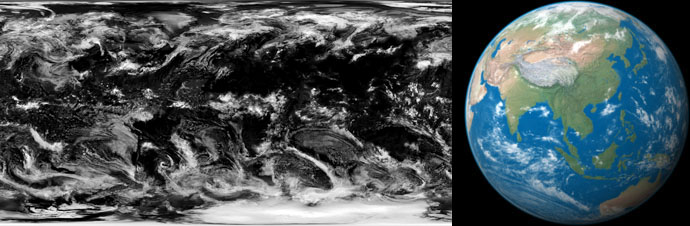
4. Asia – cloudy and hazy everywhere except South and East Asia
|
||||||||||||
|
Cloud map |
Cloud map applied to globe |
|||||||||||
 |
||||||||||||
|
Download cloud map:...8,192 x 4,096 JPEG (9 MB) |
||||||||||||
|
|
||||||||||||
|
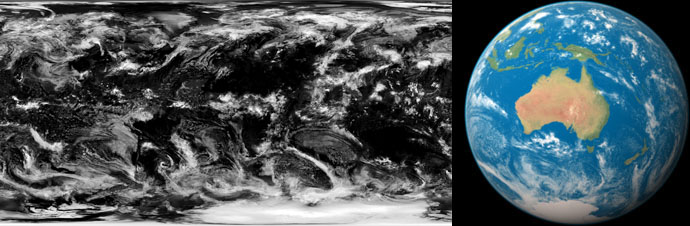
5. Australia – cloudy and hazy everywhere except Australia and New Zealand
|
||||||||||||
|
Cloud map |
Cloud map applied to globe |
|||||||||||
 |
||||||||||||
|
Download cloud map:...8,192 x 4,096 JPEG (9.2 MB) |
||||||||||||
|
|
||||||||||||
|
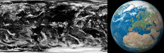
6. Europe – cloudy and hazy everywhere except Western Europe
|
||||||||||||
|
Cloud map |
Cloud map applied to globe |
|||||||||||
 |
||||||||||||
|
Download cloud map:...8,192 x 4,096 JPEG (9.2 MB) |
||||||||||||
|
|
||||||||||||
|
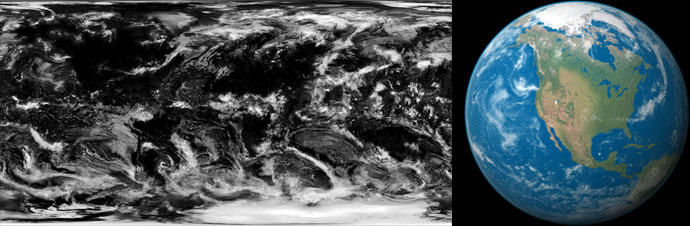
7. North America – cloudy and hazy everywhere except North America
|
||||||||||||
|
Cloud map |
Cloud map applied to globe |
|||||||||||
 |
||||||||||||
|
Download cloud map:...8,192 x 4,096 JPEG (8.9 MB) |
||||||||||||
|
|
||||||||||||
|
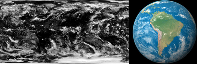
8. South America – cloudy and hazy everywhere except South America
|
||||||||||||
|
Cloud map |
Cloud map applied to globe |
|||||||||||
 |
||||||||||||
|
Download cloud map:...8,192 x 4,096 JPEG (9.2 MB) |
||||||||||||
|
|
||||||||||||
|
About the cloud maps
The cloud maps above derive from the 8,192 x 4,096 cloud map that accompanied the original NASA Blue Marble dataset released in 2002. The origin of the NASA cloud map is unknown. A close inspection of it reveals many small duplicate clouds over ocean areas, a sign of prior digital editing. Clouds on the NASA map nevertheless correspond with global weather patterns and look correct when viewed from far away, such as Earth seen from outer space. The cloud maps available here received Photoshop edits primarily to remove clouds from land areas—64 percent of Earth's surface is obscured by clouds on an average day—and to fix the most obvious duplicated clouds on the NASA image. Cloud maps 1 and 2 received considerably more editing than maps 3 through 8, which are the unaltered NASA image except for the relatively cloud-free holes over select continents. By showing cloud formations either approaching or soon after departing from continental shores, the cloud maps impart a sense of meteorological capriciousness—and luck, providing readers with a momentary clear view of familiar landmasses. Lightly populated areas with humid climates, such as subarctic Canada and Russia, and tropical rainforest regions, have more clouds than other areas. |
||||||||||||
|
Clouds parting over New Zealand |
||||||||||||
 |
||||||||||||
|
Using cloud maps The clouds maps work well when combined Natural Earth III, Texture 2. You can do this in Photoshop by copying and pasting the cloud map above the texture. Changing the blending mode of the cloud map layer from normal to screen will result in white clouds (the black areas become invisible). To change the density and brightness of the clouds, use either the Levels, Curves, or Brightness/Contrast image adjustment tools. Having a few clouds over land areas is necessary to create Earth images that look realistic. Sacrifices had to be made. If one of these clouds obscures an area of interest, or where you happen to live, you can simply delete or move it to another location. In Photoshop, set the background color to black and use the Lasso Selection Tool with a feathered edge to edit the cloud map. It is possible to combine 8,192 x 4,096 cloud maps with the larger 16,200 x 8,100 textures. However, doing this involves enlarging the cloud maps to fit the textures, which results in soft, generalized clouds in large-scale scenes. |
||||||||||||
|
|
||||||||||||
| Projection and georeferencing Download:...Projection information and world (.tfw) files (4 KB) |
||||||||||||
|
|
|
|
|
|
|||||||