Sentinel-2 Photoshop Tutorial
This example is really basic. We will just use the True Color Image (TCI) that comes with every Sentinel-2 download. It is a premade 8-bit RGB image composited from bands 4 (red), 3 (green), and 2 (blue) to simulate natural colors.
Procedure
1) Use Geographic Imager (File/Import/GI: Advanced Import...) to open the file that ends with: ...TCI.jp2. It is the last file in the IMG_Data folder.
2) If you like what you see, you're all done. Use Geographic Imager to export it as GeoTIFF (File/Automate/GI: Quick Save to Format...)
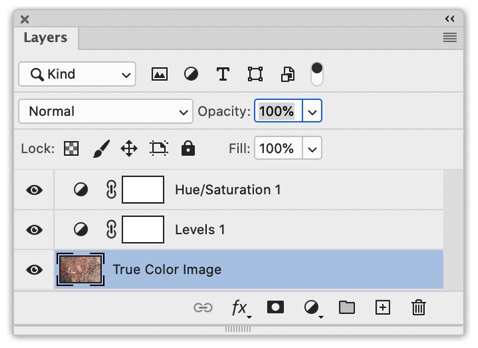
3) However, because the True Color Images are an automated product, you may need to apply Photoshop tweaks depending on the intended use and your aesthetic preference. In the example below, I used a Levels adjustment to decrease the contrast and a Hue/Saturation adjustment to slightly increase the saturation.
Tip: Use adjustment layers to manipulate the image. As the name implies, you can re-edit your adjustments if you later change your mind.
Image creation: Capitol Reef
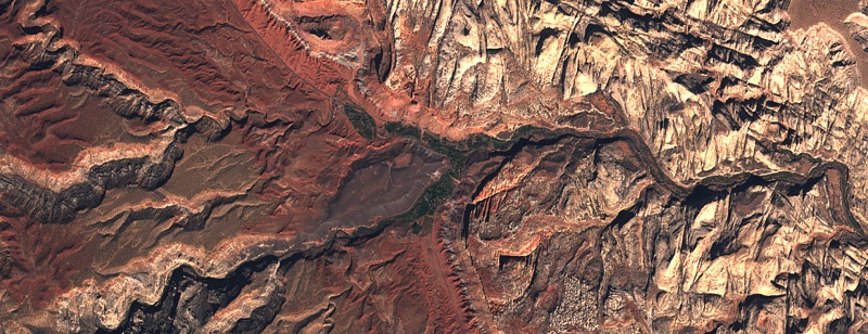
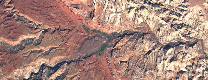
Figure 6. Capitol Reef National Park, Utah, before Photoshop adjustments (top) and after (bottom).
The adjustment layers used for the Capitol Reef image in Figure 6.
Click here to download the Photoshop file (85.6 MB)